Case Study
Loch Leven
Nutrient Modeling
Proving that floodplain reconnection works as a nutrient sink — using satellite data to measure what sensors alone cannot reach.
Proving that floodplain reconnection works as a nutrient sink — using satellite data to measure what sensors alone cannot reach.
TNC's target: reduce nutrient runoff into the Mississippi River Basin by 30% by 2030. Nitrates from agricultural fertilizer runoff accumulate downstream and produce a large hypoxic dead zone in the Gulf of Mexico. Restoring the river's natural floodplain filtration system is among the most promising nature-based interventions available.
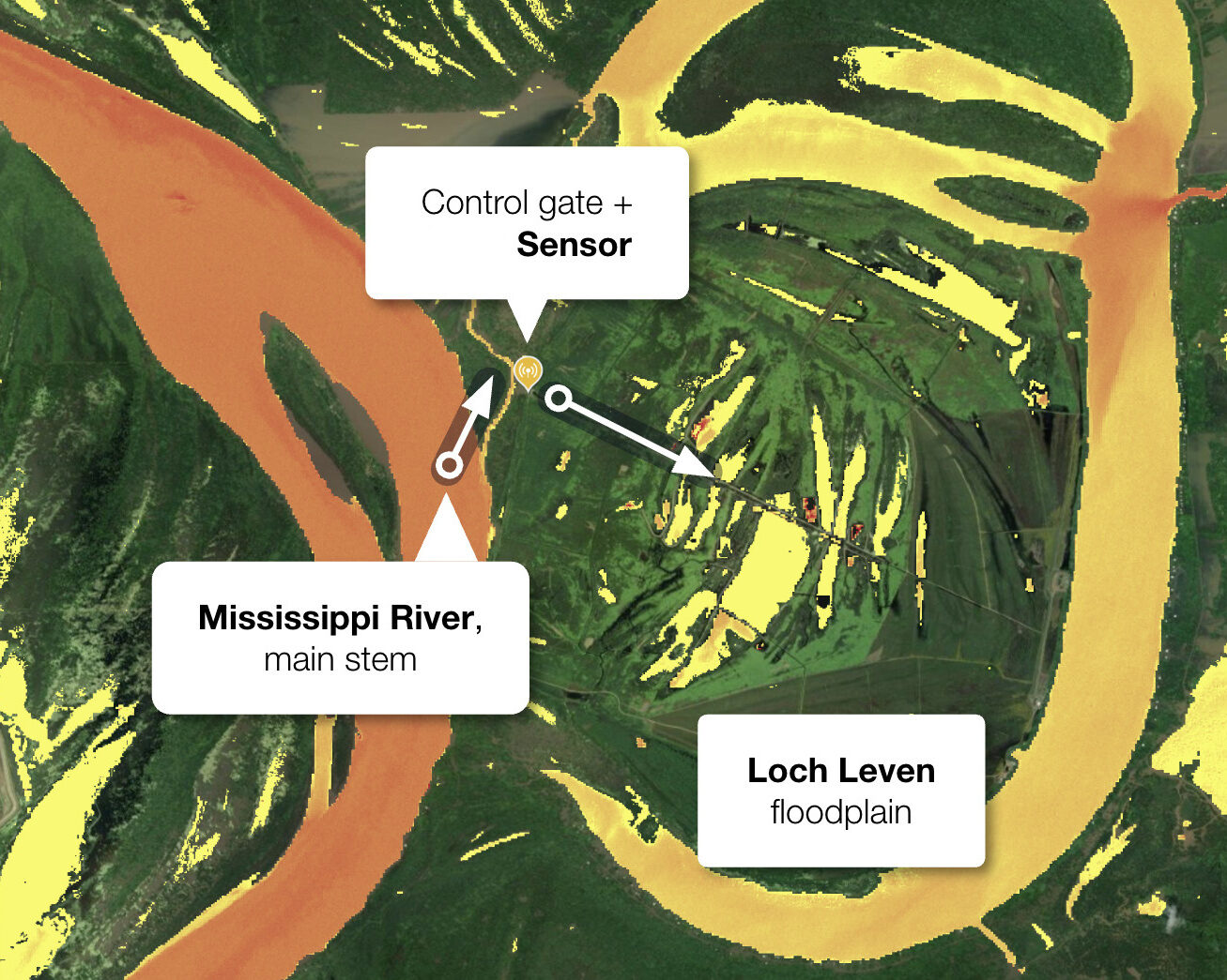
In the Mississippi, levee construction has disrupted critical biogeochemical processes that naturally filter agricultural nutrients. The Loch Leven restoration project in Wilkinson County represents the largest floodplain reconnection initiative in the Lower Mississippi River Basin — 6,000 acres hydrologically isolated for over 150 years.
Through engineered water control structures, the project has restored bidirectional water exchange between the river and its historical floodplain, creating conditions for enhanced denitrification and nutrient removal. If efficacy can be demonstrated here, this approach becomes a scalable blueprint for much larger interventions across the basin.
Quantifying nutrient reduction in a flooded, remote floodplain is harder than it sounds.
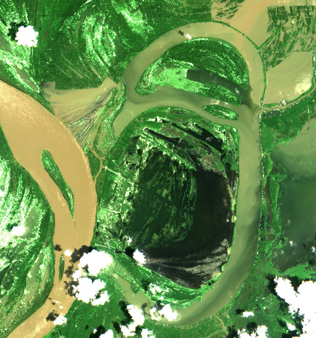
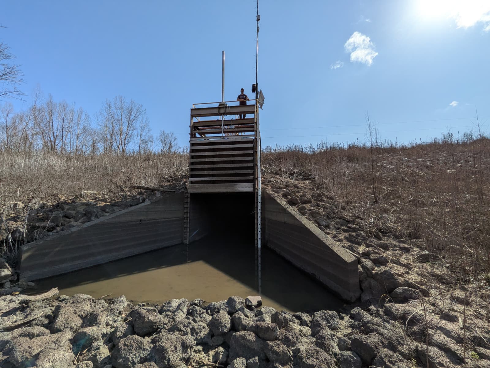
The Loch has a single in/outflow gate but is regularly inundated. This prevents clear-cut calculation of how long water — and its nutrients — actually spends inside.
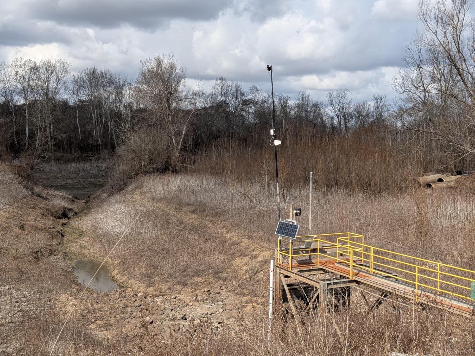
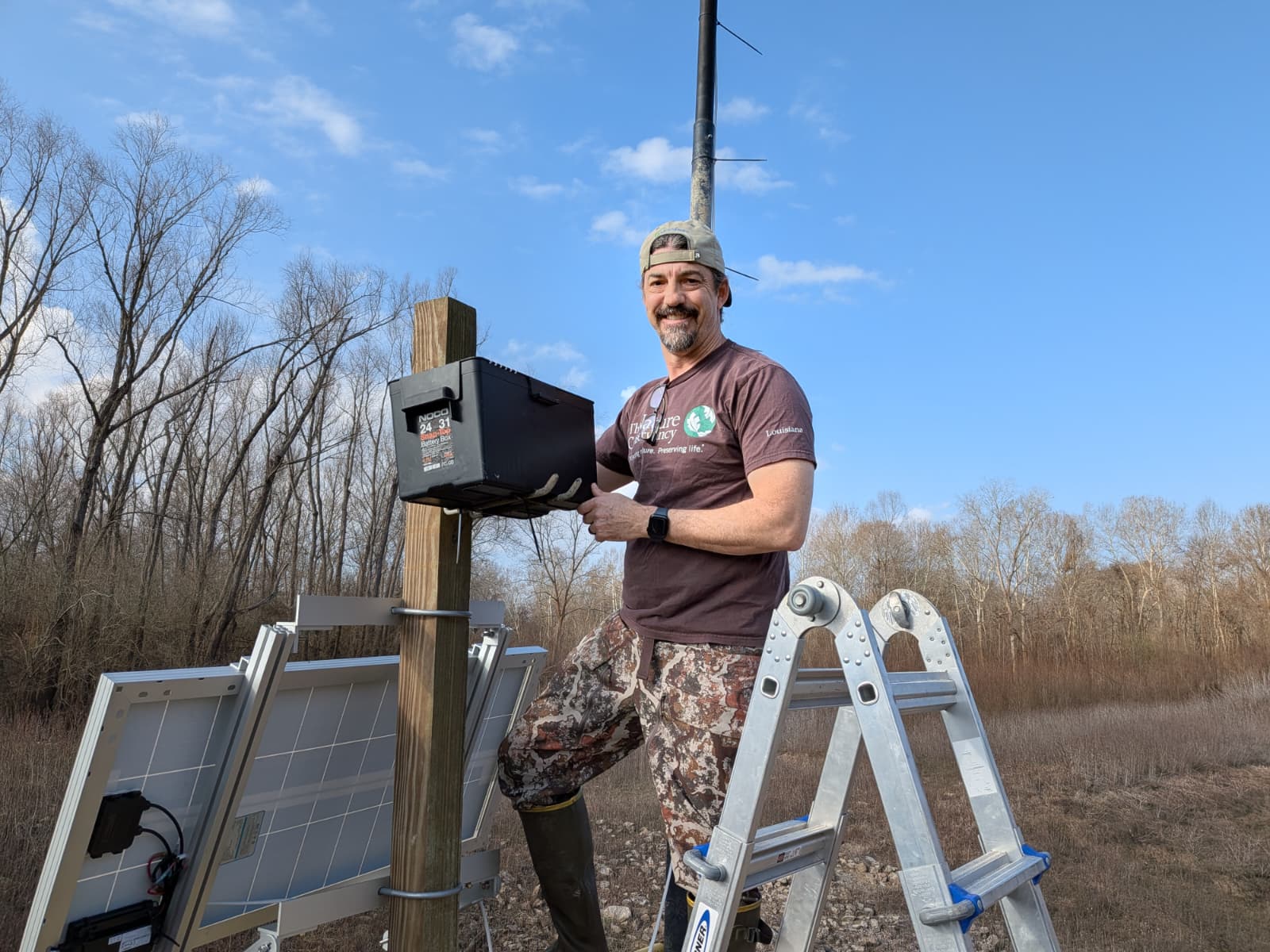
During flooding, installation and maintenance of in-situ instruments becomes dangerous or impossible. Sensors are displaced or destroyed. Ground truth is hardest to collect when it matters most.
Nutrient loads are reduced across large, spatially heterogeneous areas. A single measurement location cannot capture the spatial complexity of what the floodplain is actually doing.
Traditional field measurements require significant manual effort to deploy, maintain, and process — in an environment that actively resists access.
Understanding seasonal variability and capturing rare extreme events traditionally requires many years of data collection before confident conclusions can be drawn. Reference time series at Loch Leven are sparse and have not yet covered a full retention-release cycle — making it impossible, with traditional methods alone, to conclusively demonstrate that the site functions as a nutrient sink.
The full lifecycle of the floodplain — gate opening, flooding, nutrient reduction, and drainage back into the river — can be observed continuously from space. By connecting the physical state of the system with satellite-derived water quality data, we can estimate nutrient dynamics across the entire 6,000-acre area, at a resolution no on-the-ground sensor network could match.
The approach combines Sentinel-2 satellite imagery (every 5 days, 10–20 m resolution, back to 2017) with daily commercial imagery from Planet Labs and continuous readings from the hyperspectral sensor at the control gate — filling cloud gaps and anchoring the spatial model to ground truth.
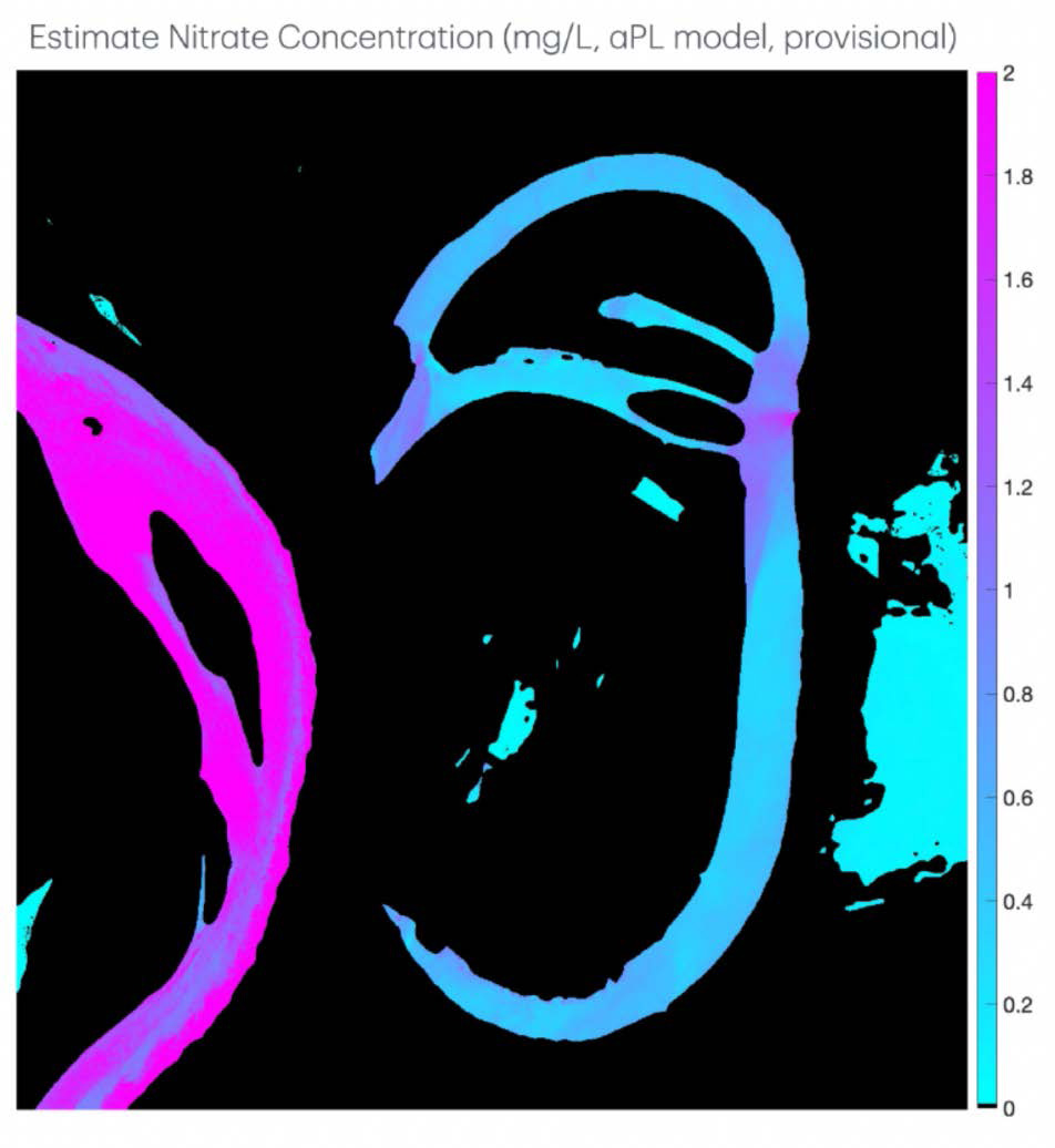
A published methodology (Tufillaro et al., 2024) demonstrates combining Sentinel-2 reflectance with in-situ gauging to map Chlorophyll-a, turbidity and sediments, and nitrate concentration. Correlations exceed R² > 0.9 during calibration windows.
The methodology was applied to the Lower Mississippi context (Tufillaro et al., 2024b). A satellite-based monitoring system was trained on sensor observations and ground reference measurements to estimate nitrate levels specifically within Loch Leven.
Planet Labs SuperDove imagery provides daily observations. The hyperspectral sensor fills temporal gaps caused by cloud cover. Together, they overcome the limitations of traditional in-situ monitoring — continuously, automatically, without requiring field access.
Preliminary data indicate that the restored floodplain achieves the anticipated reduction in nitrate concentrations, demonstrating the potential of nature-based solutions to mitigate agricultural nutrient loading contributing to Gulf of Mexico hypoxia.
Turbidity and nitrate concentrations flowing in and out of Loch Leven are estimated continuously, benchmarked against the USGS gauge 38 miles upstream at Natchez — part of a larger, ongoing cooperation providing monitoring of nutrient loads across the Mississippi watershed.
The nitrate concentration map (right) shows the stark contrast between the high-nitrate Mississippi main stem (magenta) and the floodplain water (cyan/blue) — a direct visual demonstration of denitrification at landscape scale.
A drought in 2024 kept the control structure dry, limiting validation data for the water leaving the floodplain. Reference data from a co-installed YSI sonde covers two windows in early 2024 — both prior to the flood event. The site was not accessible since severe floods in late spring 2025 until spring 2026.
We are currently awaiting resumption of reference nutrient measurements. Once available, they will allow final calibration of the nutrient model to the specific biogeochemical conditions of the Loch Leven floodplain.
Once operational, Loch Leven will be added as a dedicated tributary node to the Mississippi watershed-wide model — allowing quantitative estimation of its contribution to nutrient load reduction reaching the Gulf, and setting the stage for assessing far larger interventions like the Atchafalaya wetland system.
Sentinel-2 and Planet Labs imagery processed automatically. New data every 1–5 days depending on cloud cover.
HyperSpectral sensor at control gate upgraded August 2024 and February 2026. Measuring continuously during daylight hours.
On hold since spring 2025 floods, to be resumed in spring 2026. Resumption will enable final calibration of the nutrient model.
Improving the satellite processing chain to handle pronounced adjacency effects from dense vegetation in the narrow intake channel.
Loch Leven added as a tributary node to the Mississippi watershed model — enabling quantitative basin-scale nutrient accounting.
Loch Leven is proof of concept. The same approach — satellite + sensor fusion, automated processing, spatial nutrient maps — scales to any floodplain, wetland, or river stretch. We work with conservation organizations, water utilities, and government agencies across five continents.
Whether you're monitoring a single restoration site or an entire watershed, we can help.
Get in touch